
Intelligence Value
SMART automates broad-area search of multi-source satellite imagery to detect, monitor, and characterize the progression of anthropogenic or natural processes, such as heavy construction or crop growth. By augmenting the manual imagery analysis process with global-scale image processing and machine learning, SMART provides timely discovery and monitoring of man-made and natural change.
Summary
Manual exploitation methods fail altogether at the problem of simultaneously analyzing data from past, current, and future space-based systems. With the growing quantity and diversity of imagery collected, the Intelligence Community requires novel methodologies to improve the analysis process and efficiently distill the data into actionable intelligence.
SMART innovations in data fusion and automated reasoning techniques enable large- scale monitoring of both man-made and natural change with unprecedented temporal resolution and area coverage, erasing strategic surprise. Harmonization ensures calibration, correction, and georegistration of imagery, which allows the creation of a virtual constellation, providing the necessary coverage and temporal resolution for many intelligence problems.
Subsequently, machine learning and reasoning activities across spatial, spectral, and temporal features deliver automated sense-making against the harmonized data, enabling global alerting for changes of interest.
The SMART program will use detection and monitoring of heavy construction as an initial use case and investigate as to the transferability of the approach to other forms of natural and anthropogenic change. The ability to accurately characterize the temporal stage of dynamic processes in an automated fashion will validate the mission utility of SMART’s harmonized multi-source imagery and machine learning system.
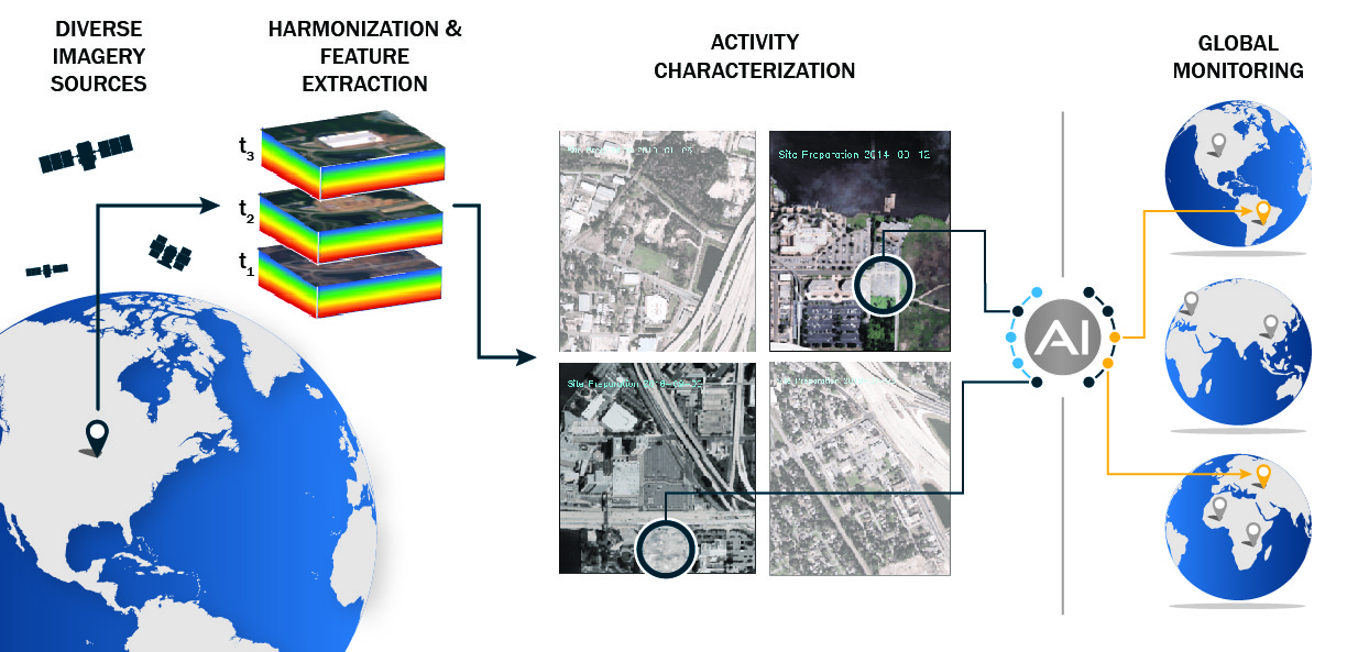
SMART's approach to broad area search harmonizes multi-modal imagery sources, extracting features, and apply machine learning models to characterize the underlying activity and provide that awareness at scale.